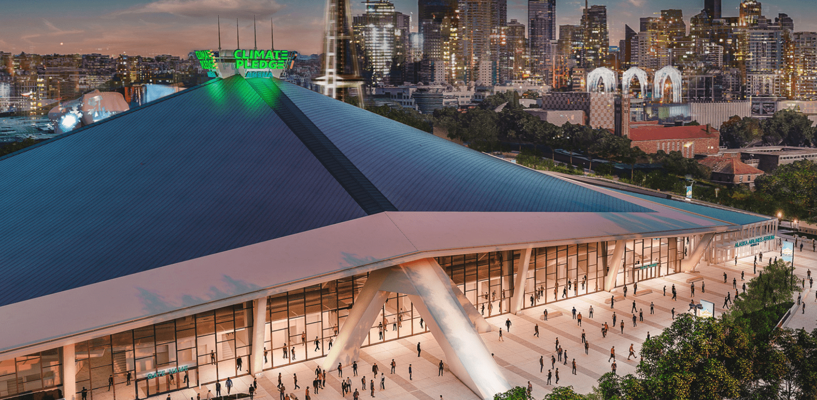
 The brand new Climate Pledge Arena opens this week. Learn about a range of travel opens to reach the arena by walking, biking, rolling, taking transit, or driving, and what to know before you go.
Links below will open new windows.
Summary:
- Walk, bike, or roll to the next Climate Pledge Arena event: We’ve been busy installing several new connections to help people safely and more easily travel to the new arena, and move through the Uptown neighborhood.
- Ride transit to the new arena: Transit is a great option too – ride the bus, take light rail, or ride the newly upgraded Seattle Center Monorail to get to arena events, and check out the new Kraken + Climate Pledge Arena mobile app, which includes access to a free transit pass with purchased tickets for Seattle Kraken home games.
- Traffic changes around the arena: Know before you go – please be aware of new traffic revisions for people driving in the area. This includes new dedicated bus lanes and protected bike lanes (PBLs) in the Uptown area.
- Parking changes: There are also several parking changes in the Uptown neighborhood and links to resources on where to park and what you can expect.
We’re excited for the new Climate Pledge Arena at Seattle Center to open and are working to make walking, biking, rolling, and taking transit all safe and predictable ways to get around near the arena. This blog details a range of options to consider for traveling to and through Seattle’s Uptown neighborhood. We encourage you to avoid driving in the area if possible during large-scale events, when significantly more people are traveling.
Walk, bike, or roll to the next Climate Pledge Arena event
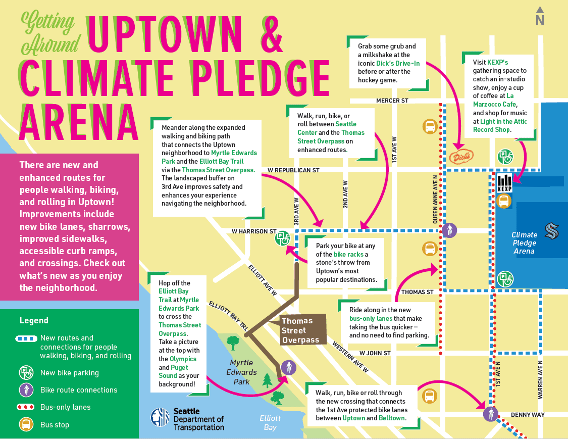
We engaged the community and partnered with the Climate Pledge Arena to develop and install several new routes to improve the experience for people walking, biking, or rolling to the arena and throughout the broader Uptown neighborhood.
Key improvements include:
- New protected bike lanes (PBLs) along 1st Ave N, Thomas St, and Queen Anne Ave N, to support safer and more comfortable travel by bike or scooter to the new arena and throughout the Uptown neighborhood.
- New bus-only lanes along Queen Anne Ave N and 1st Ave N to ensure buses can move people more predictably prior to and after arena events and all other times of the day.
- Two new traffic signals to improve traffic control and benefit safety for people walking, biking, and rolling in the area.
- Wider pedestrian crossings and curb bulbs to help accommodate larger crowds (located at 1st Ave N and Harrison St, plus 1st Ave N and Republican St).
- 157 new short-term bike parking stalls at the arena.
We’ll also close Thomas Street between 1st Ave N and Warren Ave N to vehicle traffic before and after large-scale events to promote safety for those walking, biking, and rolling in the vicinity of the arena.
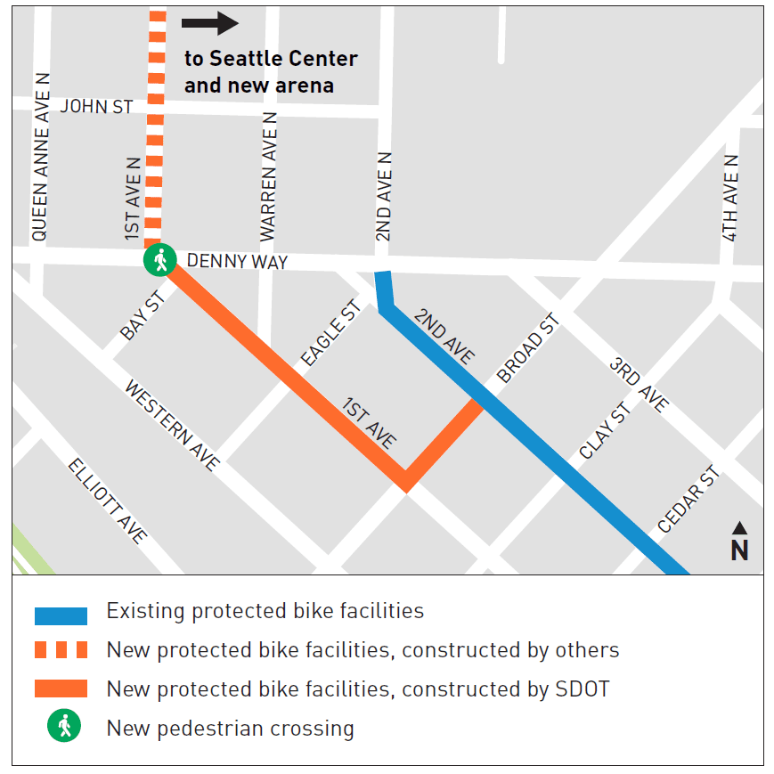
Another major improvement we recently completed is the Seattle Center to Waterfront Walking and Biking Connection that links Climate Pledge Arena to Myrtle Edwards Park and the Elliott Bay Trail. Check out this map featuring connections for people of all ages and abilities walking, biking, and rolling between the Seattle Center and the Central Waterfront via the Thomas Street Overpass, and other connections in the Uptown neighborhood.
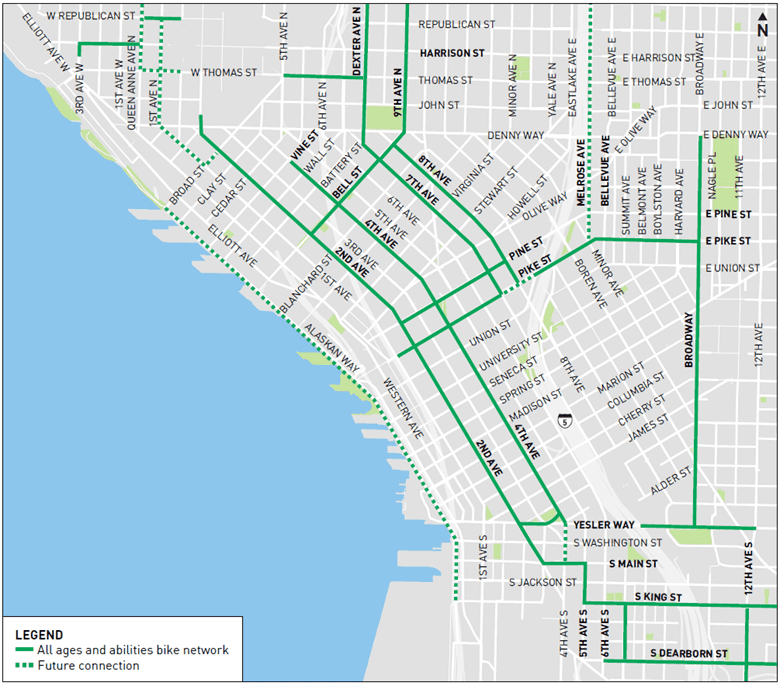
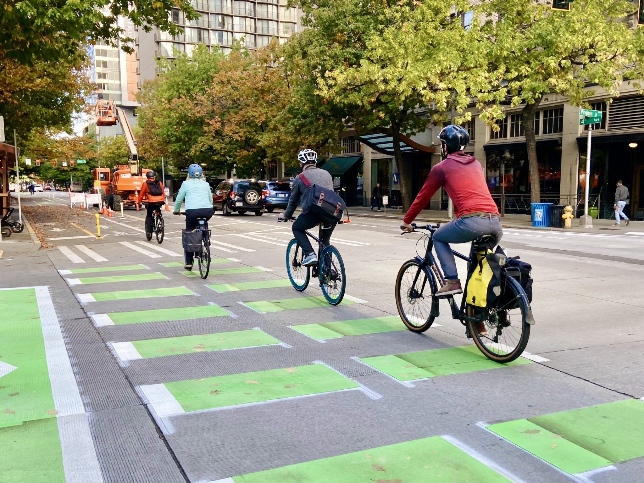
In addition, the new 2-way 4th Ave protected bike lane through downtown Seattle opened earlier this month! Completing this protected bike lane is a big step forward in advancing our Seattle Center City Bike Network, which launched in 2015. Protected bike lanes (PBLs) use barriers to separate bike and vehicle traffic, making the street safer, more predictable, and comfortable for everyone. Below is a map detailing Center City Bike Network routes for people of all ages and abilities traveling through downtown Seattle and parts of Uptown, Belltown, Pioneer Square, South Lake Union, and Capitol Hill.
Coming soon, the 1st Ave and Broad St Complete Street Extension Project will provide an all ages and abilities bicycle connection and other improvements for people walking, biking, and rolling between Belltown and Climate Pledge Arena. This network of safer non-motorized connections helps to fulfill the vision of the City’s Bicycle Master Plan, to make biking an integral part of daily life in Seattle.
This project includes 2-way protected bike lanes along Broad St between 2nd Ave and 1st Ave, and along 1st Ave between Broad St and Denny Way. These new biking routes will connect to the existing protected bike lane along 2nd Ave in downtown Seattle. This project will also connect to the 1st Ave N and Queen Anne Ave N protected bike lanes, completing the bike network between the Belltown and Uptown neighborhoods.
Ride transit to the arena
Transit is a great way to get to the arena without having to deal with parking. We’ve made some changes to increase the speed and reliability of transit, including building bus-only lanes on 1st Ave N between Denny Way and Republican St, and on Queen Anne Ave N between Mercer St and John St.
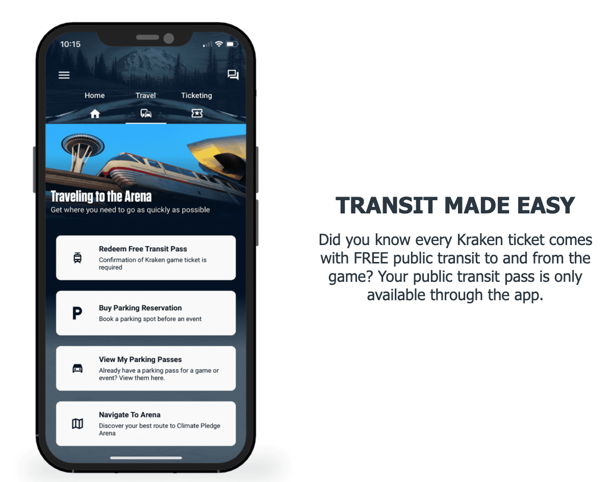
If you’re going to a Seattle Kraken hockey game, download the Kraken + Climate Pledge Arena mobile app to receive a free transit pass on game nights! Visit the Seattle Kraken’s website for additional guidance on transportation and how to use the free transit passes via the mobile app.
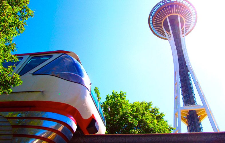
Additional transit options include riding from one of the newest Sound Transit Link light rail stations in the U District, Roosevelt, and Northgate neighborhoods, or taking the Seattle Center Monorail.
The Seattle Center Monorail is the City of Seattle’s dedicated rail line, traveling between Seattle Center and Westlake Center in less than two minutes. Monorail service resumed service last week after extensive upgrades. This work modernizes the monorail system, provides better access to the red and blue trains, improves the connection to Link light rail system and regional bus network, increases the size of the passenger boarding area at Westlake Station and adds ticket machines and a faregate system at both stations. The Monorail accepts all forms of payment, including your ORCA card. Learn more at seattlemonorail.com.
Traffic changes around the Climate Pledge Arena
We encourage everyone to take advantage of the many different travel options available to get to the arena, while avoiding driving in this busy area during events, when possible. If you choose to drive, please be aware of the traffic changes in the area, especially west of Seattle Center, closest to the Climate Pledge Arena. As you travel, please proceed with caution, pay close attention to street signage, and keep an eye out for other travelers who are walking, biking, and rolling.
Important traffic changes include the following:
- 1st Ave N now has one through-lane for drivers from Denny Way to Thomas St. Drivers will not be allowed to turn left on to John St or Thomas St from 1st Ave N.
- Queen Anne Ave N now has one through-lane for drivers from Mercer St to John St. Drivers will not be allowed to turn left on to Republic St, Harrison St, or Thomas St from Queen Anne Ave N.
- Thomas St between Queen Anne Ave N and 1st Ave N is now one-way eastbound only from the alleyway to the east, and two-way from the alleyway to the west.
- Thomas St between 1st Ave N and Warren Ave N will be closed to vehicles before and after events with 10,000 or more attendees. The street will remain open to people walking, rolling, and biking.
Parking changes
When you’re taking transit, or walking, biking, or rolling you avoid paying for parking! But if you need to drive, please prioritize one of the several nearby parking garages to save yourself time and help reduce traffic congestion for everyone. Additional details regarding parking in the Uptown neighborhood is available on our Parking Program – Uptown web page. You can also pre-pay and reserve a spot through the Climate Pledge Arena tickets webpage (operated by Ticketmaster), or through the Climate Pledge Arena app listed above.
Street parking is prioritized for people who live in the Uptown neighborhood and for people shopping at local businesses. To help support local residents and businesses, we worked with community members and the Uptown Alliance to modify the Uptown neighborhood Restricted Parking Zone area. We’ll also implement special event parking rates and rules starting October 22, 2021. On most event nights, from 5 to 10 PM, the parking rate will be $3 per hour for the first two hours, then go up to $8 for each hour after that.
We hope you enjoy the new Climate Pledge Arena and are able to walk, bike, roll, or take transit to reach your next event!